Paragliding Óbidos
Back

Sponsored by

Paragliding Óbidos
Alpyr

Paragliding Óbidos

Region: europe | Country: Portugal | language: en
Popularity: 297 Views

May Jun Jul Aug Sep Oct

Weather Statistics Óbidos

History of Maximum Temperatures | | Óbidos

JanFebMarAprMayJunJulAugSepOctNovDec
0°c 5 10 15 20 25 30 35 40

History of Daily Maximum Wind Speeds | | Óbidos

JanFebMarAprMayJunJulAugSepOctNovDec
0 kmh 5 10 15 20 25 30 35 40

History of Maximum Cloud Ceilings | | Óbidos

JanFebMarAprMayJunJulAugSepOctNovDec
0 m 500 1000 1500 2000 2500 3000 3500 4000

History of Daily Rainfall Accumulations | | Óbidos

JanFebMarAprMayJunJulAugSepOctNovDec
0 mm 5 10 15 20 25 30 35 40


Where to stay at Óbidos

Where Paragliding | Óbidos | Spots map

Find automatically the best sessions nearby in 1 click.

  • 🤖 Automated Forecast algorithm 7d/7
  • 🗺️ Atlas of 32 000 spots
  • Automatic updates (4 times daily)
  • 🛰️ High Resolution Model, Hour by hour
  • 🧭 Radar 50 | 100 | 200 km
  • 💨 16 Weather Models
  • 🔒 Private spot creation
  • ✅ No Ads
  • ✅ Priority Assistance
  • 💪 Support for site development and maintenance 🙏
  • And more...
36$ 9.99$ //year

The best spots of Paragliding | Óbidos

Nazaré S

Paragliding map of
Optimal Wind Direction
SSE S SSW

Optimal Speed (kmh)

soaring spot for advanced flyers. works only a few time a year. Landing on the beach.
Click to watch video
Youtube Video Thumbnail
 
Click to watch video
Youtube Video Thumbnail
https://www.youtube.com/watch?app=desktop&v=GC-iEB1ynH0
Popularity: 427 Views

Lagoa de Obidos

Paragliding map of
Optimal Wind Direction
N NNE NNW

Optimal Speed (kmh)

Click to watch video
Youtube Video Thumbnail
Popularity: 281 Views

Praia da Gralha

Paragliding map of
Optimal Wind Direction
WSW

Optimal Speed (kmh)

soaring spots for experienced pilots.
Click to watch video
Youtube Video Thumbnail
Popularity: 260 Views

xxx Nazare Nazaré 1

Paragliding map of
Optimal Wind Direction
SE SSE S SSW SW WSW

Optimal Speed (kmh)

Military airspace is closed for paragliding in the LP R60A airspace between the surface and 4000 feet, spanning from Nazaré to near Figueira da Foz. Violating this airspace is considered a very serious aeronautical infraction and can result in large fines. For more details, visit [Cavok Portugal](https://cavok.pt/fuaflex/fua-portugal/). The main takeoff point is regularly used and offers nice local soaring opportunities. The site record for distance is 15.1 km. There are two takeoff options: the one represented here and another on the left side of the elevator (from the beach to the top). Note that flying is not allowed in July and August. Landing is on the beach. The takeoff directions are SE, S, and SW. The coordinates are N: 39.60462, W: -9.0787. This site is suitable for paragliders of levels 1 and 2. Access is available by car or on foot, and the altitude is 99 meters. For more information, you can watch a video of the site [here](
Click to watch video
Youtube Video Thumbnail
).
Popularity: 239 Views

Praia da Gralha Sao Martino do Porto

Paragliding map of
Optimal Wind Direction
N W WNW NW NNW

Optimal Speed (kmh)

Located in Portugal, Praia da Gralha is a frequently used coastal soaring spot with a maximum altitude of 90 meters. The takeoff orientation is primarily northwest and west. Access to the site is good, with a route from S. Martinho do Porto leading to the highest part of the village, followed by a dirt road to the takeoff area. Takeoff is usually done from the beach, and top-landing is easily achievable at any point on the plateau. The flying conditions are predominantly dynamic and very stable, allowing for easy transitions to Praia do Salgado. Landing on the beach is straightforward due to the extensive sandy area, and top-landing is also quite accessible. If you land on the beach, you can either walk a short distance back to the takeoff point or drive up. The most favorable conditions are with laminar west winds. Interestingly, flights are also relatively good with north and northwest winds due to the beach's shell-like configuration, which influences the wind path from the north. However, caution is advised regarding the west-facing cliff, which has an irregular relief. The southwest-facing wall is rarely used due to the difficulty and danger of takeoff. For more information, you can visit [SkyXplorer](https://www.skyxplorer.com/zonas-de-voo/). Flights in this area have a site record of 26.2 km.
Popularity: 206 Views

Praia dos Salgados Saraiva

Paragliding map of
Optimal Wind Direction
WSW W WNW NW NNW

Optimal Speed (kmh)

Altitude: 114 meters, Length: 6,600 meters This site is primarily used by hang gliders, with occasional use by paragliders. Region: Portugal Site record: 29.0 km Region: Nazaré, Portugal Site record: 4.1 km Region: Portugal Site record: 2.0 km Flights: [Facebook Photo](https://www.facebook.com/Port.paragliding/photos/pcb.2005106256435443/2005106193102116/?type=3&theater), [YouTube Video](
Click to watch video
Youtube Video Thumbnail
), [SkyXplorer](https://www.skyxplorer.com/zonas-de-voo/), [Windy](https://www.windy.com/39.546/-9.102?39.485,-9.102,11), [Rotas do Vento](http://rotasdovento.com/gca/?id=115) Altitude: 124 meters Elevation Gain: 124 meters Takeoff Orientation: W, NW Praia dos Salgados is located between Nazaré and S. Martinho do Porto. To get there, head to Nazaré and drive towards S. Martinho do Porto along the coastal road. The beach is signposted on the right (left if coming from S. Martinho). Takeoff: Located on the cliff in front of the Inatel Hang Gliding School (signposted). There are two takeoff points; use the lower one when the wind is strong at the top. Landing: On the beach, in front of the parking lot. Retrieve: Very easy, via asphalt road, 4 km round trip. Flight Type: Contrary to the calm flights typically expected along the coast, this site can be quite turbulent in the summer due to thermodynamic conditions. Exercise caution as many accidents occur due to overconfidence. Takeoff: Well-prepared small clearing Takeoff Directions: N, W, NW Coordinates: N: 39.54356, W: -9.10791 Suitable for Paragliding and Hang Gliding: Levels 1 and 2 Access: By car, on foot Altitude: 113 meters (maximum altitude difference of 104 meters for this location) For more information, visit [SkyXplorer](https://www.skyxplorer.com/zonas-de-voo/).
Popularity: 187 Views

Praia dos Salgados 2

Paragliding map of
Optimal Wind Direction
WNW NW NNW

Optimal Speed (kmh)

Nazaré, Portugal offers a takeoff ramp at an elevation of 96 meters. This site is more frequently used by hang gliders than paragliders, but it does provide various takeoff options for both. The site record for the longest flight is 8.8 km. For more information on flights near this point, you can visit the local paragliding community pages or forums.
Popularity: 169 Views

Praia de Santa Cruz Praia de Santa Rita

Paragliding map of
Optimal Wind Direction
WSW W WNW NW NNW

Optimal Speed (kmh)

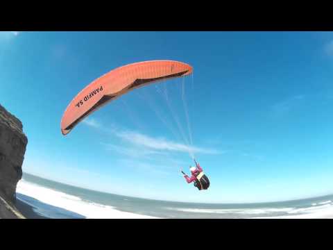
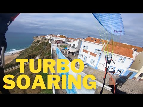
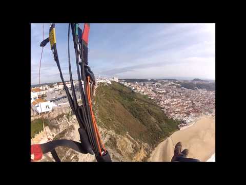
In the region of Torres Vedras, Portugal, the paragliding site at Santa Rita Beach offers a fine coastal soaring experience. The takeoff is located on the left side of the beach when facing the sea, opposite the hotel, at the top of the cliff. Look for a sign on the road indicating "Miradouro" to find the spot. 
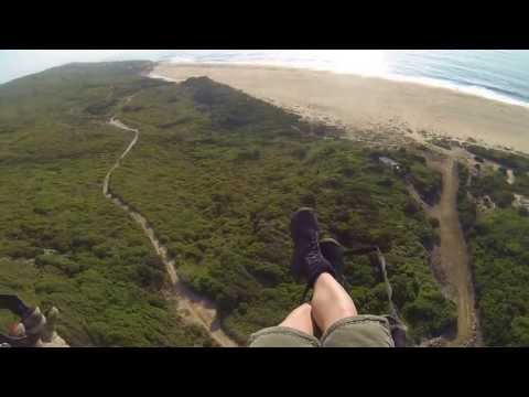
The site features a height difference of 40 meters and is oriented towards the West and Northwest. It is situated north of Santa Cruz, a village 15 km from Torres Vedras, which has an aerodrome, an aeroclub, and is close to the Hotel do Vimeiro, thermal baths, and a golf course. The cliff extends to Santa Cruz and ends before the Hotel do Vimeiro at Praia de Santa Rita. To reach the takeoff, take the first left turn from the road that exits Santa Cruz heading north, onto a road parallel to the coastline, passing by the Faraó nightclub. About 1 km along, there is a dirt and sand detour marked with logs on the sides. The takeoff is about 100 meters from this point. The Hotel do Vimeiro is visible from both the takeoff and the road. This beach is a popular gathering spot for many paragliders and schools, both local and visiting. The cliff offers a larger height difference at the beach behind the hotel, visible to the north of Santa Rita, which serves as a good alternative during heavy air traffic. The simplest access is through the hotel, although there have been issues with car passage to the takeoff, which are expected to be resolved soon. Alternatively, you can enter the beach from the north side. The takeoff area is a flat terrain at the top of the cliff, easily identifiable to the left of the parking area where the dirt detour ends. It is suitable for schools and beginner pilots. The wide takeoff area is excellent for top-landing, and flights are possible with NW winds starting from 17 km/h. 
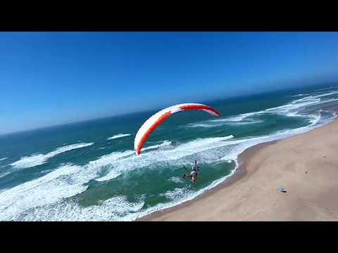
Landing is straightforward with normal flight conditions, and there is a large beach extending along the cliff. However, be cautious during high tide as the beach may narrow in some areas. The walk from the beach to the parking or takeoff area takes about 5 minutes. For more information, visit: - [Paragliding in Portugal Facebook Page](https://www.facebook.com/Port.paragliding) - [AVLS Paragliding](http://www.avls.pt/DesktopDefault.aspx?tabid=100)
Popularity: 168 Views

Falezia Hotel Praia Valmitao Ribamar

Paragliding map of
Optimal Wind Direction
WSW W WNW NW

Optimal Speed (kmh)

Located in Portugal, this paragliding site offers a coastal soaring experience with several takeoff options. Toplanding is possible, making it a versatile spot for pilots. The site has an altitude of 56 meters, with a maximum altitude difference of 38 meters. The site is suitable for pilots of levels 1 and 2. You can access the takeoff points either by car or on foot. The takeoff directions are primarily west (W) and northwest (NW). The coordinates for the site are N: 39.19576, W: -9.34853. The site record for the longest flight is 43.1 km. For more information, you can view nearby flights at this point.
Popularity: 158 Views

Paraia de Salir do Porto

Paragliding map of
Optimal Wind Direction
ESE SE SSE

Optimal Speed (kmh)

Little dune for soaring
Popularity: 153 Views

Foz do Arelho Lagoa de Obidos

Paragliding map of
Optimal Wind Direction
N NNE NE WNW NW NNW

Optimal Speed (kmh)

Located in the West region of Portugal, this paragliding site offers a ridge with a height of 15-30 meters and a length of 3,500 meters, primarily facing northwest. It is a popular spot for local soaring, especially with a north wind. When the northwest wind is strong and sustained, experienced pilots can also enjoy some cross-country flights down the coast. This site is excellent for school training and playing on the dunes, particularly with winds from the north to northeast. The maximum altitude difference here is 20 meters, making it suitable for beginner and intermediate pilots (Levels 1 and 2). Access is convenient by car, followed by a short walk. The site record for distance is 16.1 km. For more visual insights, you can check out these videos: - [Video 1](
Click to watch video
Youtube Video Thumbnail
) - [Video 2](
Click to watch video
Youtube Video Thumbnail
) - [Video 3](
Click to watch video
Youtube Video Thumbnail
) Coordinates for takeoff are N: 39.42522, W: -9.23982.
Popularity: 151 Views

Praia de Ferrel

Paragliding map of
Optimal Wind Direction
N NNE NW NNW

Optimal Speed (kmh)

This site in Portugal is rarely used and offers many takeoff options, primarily for coastal soaring. There is no specific designated takeoff point, so you'll need to find a suitable spot for yourself. The site record is 2.9 km.
Popularity: 140 Views

Montejunto Oeste

Paragliding map of
Optimal Wind Direction
N NNE WSW W WNW NNW

Optimal Speed (kmh)

Located in Portugal, this paragliding site offers an elevation of 528 meters with a height difference of 353 meters. It is regularly used for thermal soaring, and small cross-country flights are possible here. The site has a notable flight record of 239.6 km. Takeoff directions are North, West, and Northwest. The coordinates for the site are N: 39.1805, W: -9.07264. It is suitable for both paragliding and hang gliding, catering to pilots of levels 1 and 2. Access to the site is possible by car followed by a short walk. The altitude at the takeoff point is 522 meters, with a maximum altitude difference of 414 meters for this location. For more information, you can view nearby flights at this point.
Popularity: 137 Views

Alcobertas Serra dos Candeeiros

Paragliding map of
Optimal Wind Direction
ENE E ESE SE SSE

Optimal Speed (kmh)

In Rio Maior, Portugal, there is a paragliding site with an altitude of 470 meters and a height difference of 220 meters. The takeoff orientation is towards the northwest and west. Access to the site is via the EN 1 road towards Rio Maior, continuing to Alto da Serra. From there, take the road that ascends to the PNSAC Welcome Center, follow it for another 6 km, and turn left at the fork onto a dirt road. Immediately turn left again and proceed to the takeoff area. The takeoff area is spacious, utilizing terraces left by two abandoned quarries, with some improvements made for better usability. The slope is not very steep but provides good dynamic support right after the initial steps. The flight is primarily thermodynamic. In the mid-afternoon during summer, the arrival of the sea breeze can make the flight quite unstable. From this takeoff, you can traverse the entire western slope of Serra dos Candeeiros, with the highest gain recorded being about 500 meters above the takeoff point. Landing is done in a cultivated field at the base of the slope. The field is quite long, offering no precision problems. Retrieval takes about 15 minutes by off-road vehicle, as the landing area is a few hundred meters from the EN 1 road. For more information, you can visit [Rotas do Vento](http://rotasdovento.com/gca/?id=115) and [Zonas de Vuelo](http://www.zonasdevuelo.com/zonasvuelo.html?fz=567). Additionally, you can watch some flights from this site on YouTube: - [Flight Video 1](
Click to watch video
Youtube Video Thumbnail
) - [Flight Video 2](
Click to watch video
Youtube Video Thumbnail
)
Popularity: 137 Views

Montejunto Avenal

Paragliding map of
Optimal Wind Direction
N NNE NW NNW

Optimal Speed (kmh)

Montejunto, Portugal This site is occasionally used for paragliding, with opportunities for soaring and small cross-country flights. The takeoff is at an elevation of 359 meters. The site record is 5.6 km. The wind orientation is primarily from the North and North-Northwest, with some influence from the West. Landing and retrieval areas are located approximately 2 km from the takeoff point. For more details, visit: [SkyXplorer](https://www.skyxplorer.com/zonas-de-voo/) Check current wind conditions: [Windy](https://www.windy.com/39.179/-9.042?39.164,-9.042,13,m:eKrafT4)
Popularity: 135 Views

Serra do Arrimal

Paragliding map of
Optimal Wind Direction
N W WNW NW NNW

Optimal Speed (kmh)

This paragliding site in Portugal offers a mix of thermal and dynamic soaring, making it suitable for small cross-country flights. The takeoff is at an altitude of 475 meters with a height difference of 150 meters. The site is regularly used, especially on weekends, when locals often request airspace clearance. The area in front of the takeoff features a thermally active valley followed by another ridge. The wind conditions vary throughout the day; mornings are often not flyable, but afternoons can be good with a light seabreeze. Be aware of changing zones of turbulence and consult with locals for the best flying times and conditions. Toplanding is possible, and the meeting point is at the takeoff. The drive up to the takeoff is conveniently short, although the height difference is relatively small. The site record is 76.7 km. For more visual information, you can check out these videos: - [Video 1](
Click to watch video
Youtube Video Thumbnail
) - [Video 2](
Click to watch video
Youtube Video Thumbnail
) - [Video 3](
Click to watch video
Youtube Video Thumbnail
&list=UUz7iAJGUQ2AXOeegtY1fXBQ&index=22) Coordinates for the takeoff are NWN: 39.48072, W: -8.87703. The site is suitable for pilots of levels 1 and 2, and can be accessed by car or on foot.
Popularity: 131 Views

Praia da Areia Branca

Paragliding map of
Optimal Wind Direction
WSW W WNW

Optimal Speed (kmh)

The site is located in Sines, Alentejo, with a takeoff orientation towards the west. The altitude and elevation difference are both 30 meters. For more details, you can visit [SkyXplorer](https://www.skyxplorer.com/zonas-de-voo/). For additional information, you can also check [Rotas do Vento](http://rotasdovento.com/gca/?id=115).
Popularity: 127 Views

Montejunto Sul

Paragliding map of
Optimal Wind Direction
SE SSE S SSW SW WSW

Optimal Speed (kmh)

This site, located in Portugal, is occasionally used for soaring and small cross-country flights. It is suitable for both hang gliding (HG) and paragliding (PG). The elevation difference is 300 meters, with takeoff orientations to the East, South, North, and West. The best conditions are typically from the East and South. The South takeoff is situated a few meters below the antennas at the highest point of the mountain. The East takeoff is accessed via the military barracks at the crossroads before the mountain summit, followed by a dirt road that may be challenging for low-clearance vehicles. The East landing area is a large, obstacle-free field next to the access road to the mountain. This is a thermal flying site, and it is advisable to avoid Northeast wind conditions. Be cautious of the West or Northwest breeze, which is common due to the proximity to the sea. For more information and to view nearby flights, you can visit [link not provided]. The site record is 17.9 km.
Popularity: 124 Views

casal da Galiota

Paragliding map of
Optimal Wind Direction
N NW NNW

Optimal Speed (kmh)

H 14 m is a lesser-known paragliding site. It is primarily used for soaring flights. Due to its limited popularity, you might find fewer pilots here, making it a quieter spot for those looking to practice or enjoy a peaceful flight. The site is not frequently visited, so it may lack some of the amenities and infrastructure found at more popular locations.
Popularity: 122 Views

Serra do Picoto - Columbeira

Paragliding map of
Optimal Wind Direction
N NNE NNW

Optimal Speed (kmh)

Located in Bombarral, Portugal, this paragliding site has a height of 135 meters. It is rarely used and primarily suitable for soaring. The site record is 0.5 km. For a visual overview of the location, you can watch this video: [Bombarral Paragliding](
Click to watch video
Youtube Video Thumbnail
).
Popularity: 120 Views

Baleal

Paragliding map of
Optimal Wind Direction
N NNE NE NW NNW

Optimal Speed (kmh)

This location offers a unique paragliding experience right on the beach. While primarily used for powered paragliding (PPG) takeoffs, it can also accommodate paragliding (PG) and hang gliding (HG) flights when the wind conditions are strong. The site is situated in Portugal, although the specific region is not mentioned. The site record for distance flown here is 5.7 km. For more information on paragliding in Portugal, you might want to visit local paragliding clubs or forums.
Popularity: 115 Views

Sierra de Montejunto East

Paragliding map of
Optimal Wind Direction
NNE NE ENE ESE SE SSE

Optimal Speed (kmh)

Located in Portugal, this paragliding site offers a height of 484 meters and a height difference of 373 meters. It is regularly used and small cross-country flights are possible. While it is slightly better suited for hang gliding, it is still suitable for paragliding. The site record is 31.0 km. The take-off orientations include East, South, North, and West, with the best conditions typically found for East and South take-offs. The South take-off is located a few meters below the antennas at the highest point of the mountain, while the East take-off is accessed via a military base at the crossroads before the mountain summit, followed by a dirt road that may be challenging for low-clearance vehicles. The East landing area is a large, obstacle-free field next to the access road to the mountain. This is a thermal flying site, and it is advisable to avoid Northeast wind conditions. Be cautious of the West or Northwest breeze, which is common due to the proximity to the sea. For more information, you can watch these videos: [Video 1](
Click to watch video
Youtube Video Thumbnail
) [Video 2](
Click to watch video
Youtube Video Thumbnail
)
Popularity: 109 Views

Praia de Ferrel alternative

Paragliding map of
Optimal Wind Direction
N NNE NW NNW

Optimal Speed (kmh)

This paragliding site in Portugal is rarely used and primarily suitable for soaring. The site record is 2.9 km.
Popularity: 108 Views

Falezia hotel S. Rita Hotel

Paragliding map of
Optimal Wind Direction
W WNW NW

Optimal Speed (kmh)

This paragliding site in Portugal has a height of 72 meters. It is occasionally used and is suitable for soaring and small cross-country (XC) flights. The site record for the longest flight is 63.7 km.
Popularity: 107 Views

-HG Montejunto Norte

Paragliding map of
Optimal Wind Direction
NNE NE ENE

Optimal Speed (kmh)

This site features a takeoff point at an elevation of 544 meters. It is a rarely used cliff takeoff, primarily suited for hang gliding rather than paragliding. Cross-country flights are possible from this location. Region: Portugal Site record: 63.1 km For more information, you can view nearby flights at this point.
Popularity: 107 Views

Closest partner

Find automatically the best sessions nearby in 1 click.

  • 🤖 Automated Forecast algorithm 7d/7
  • 🗺️ Atlas of 32 000 spots
  • Automatic updates (4 times daily)
  • 🛰️ High Resolution Model, Hour by hour
  • 🧭 Radar 50 | 100 | 200 km
  • 💨 16 Weather Models
  • 🔒 Private spot creation
  • ✅ No Ads
  • ✅ Priority Assistance
  • 💪 Support for site development and maintenance 🙏
  • And more...
36$ 9.99$ //year