Sponsored by

Alpyr
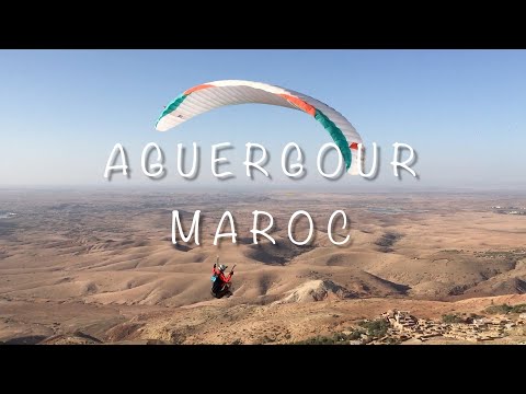
Paragliding Aguergour
Region: africa | Country: Morocco | language: en
Popularity: 524 Views
Weather Statistics Aguergour
History of Maximum Temperatures | | Aguergour
JanFebMarAprMayJunJulAugSepOctNovDec
0°c
5
10
15
20
25
30
35
40
History of Daily Maximum Wind Speeds | | Aguergour
JanFebMarAprMayJunJulAugSepOctNovDec
0 kmh
5
10
15
20
25
30
35
40
History of Maximum Cloud Ceilings | | Aguergour
JanFebMarAprMayJunJulAugSepOctNovDec
0 m
500
1000
1500
2000
2500
3000
3500
4000
History of Daily Rainfall Accumulations | | Aguergour
JanFebMarAprMayJunJulAugSepOctNovDec
0 mm
5
10
15
20
25
30
35
40
Why go to Aguergour
Aguergour is a prime destination for paragliding enthusiasts due to its exceptional flying conditions, which include generous thermals and breathtaking views of the Atlas Mountains and the plains of Marrakech. The site is accessible, located just an hour's drive from Marrakech, making it an ideal spot for both beginners and experienced pilots. The local hospitality, particularly at Ahmed's gite, enhances the experience, offering a warm welcome and a comfortable stay for pilots and visitors alike.
Best time to fly
The optimal period for flying in Aguergour is during the spring and autumn months. These seasons offer the most favorable weather conditions for paragliding, with stable air, comfortable temperatures, and the best thermal activity. This timeframe allows pilots to fully enjoy the thermals and the scenic beauty of the area.
Local weather specifics
Aguergour benefits from excellent meteorological conditions for paragliding. The area is known for its generous thermals, which are conducive to both thermal flying and cross-country tasks. The weather conditions in Aguergour allow for a wide range of flying activities, making it a beloved spot for paragliding enthusiasts from around the world.
Tizi n'Test
The altitude restrictions at Tizi n'Test hint at a site that is significantly affected by local weather patterns, including wind speeds and thermal activity. Pilots need to be mindful of the weather conditions and adhere to the altitude limits imposed for safety reasons .
Alt Ourir
Given the complexities of flying in Morocco, including the need for authorizations and the potential for airspace restrictions, pilots interested in Tizi n'Test and Alt Ourir should also ensure they are fully compliant with local regulations. Engaging with local flying communities and schools can provide valuable insights and assistance in navigating these requirements .
Pilots planning to fly in Aguergour should be aware of the importance of obtaining proper flying authorizations and respecting local regulations and airspace restrictions. Recent events have underscored the need for compliance with these requirements to ensure a safe and enjoyable flying experience. It's recommended to stay informed about any local issues that may affect flying activities and to engage with the local flying community for guidance and support
XC Track Highway

Where to stay at Aguergour
Where Paragliding | Aguergour | Spots map
Find automatically the best sessions nearby in 1 click.
- 🤖 Automated Forecast algorithm 7d/7
- 🗺️ Atlas of 32 000 spots
- ⚡ Automatic updates (4 times daily)
- 🛰️ High Resolution Model, Hour by hour
- 🧭 Radar 50 | 100 | 200 km
- 💨 16 Weather Models
- 🔒 Private spot creation
- ✅ No Ads
- ✅ Priority Assistance
- 💪 Support for site development and maintenance 🙏
- And more...
36$
9.99$
//year
The best spots of Paragliding | Aguergour
Aguergour
/-8.06551784276963,31.2970359034577,13/600x300@2x?access_token=pk.eyJ1Ijoic2Vic3dhbiIsImEiOiJjbGZsZ3E1MWowMXRtM3JucGZsbmVsNWlxIn0.NRc39EhAm1tQjmYNgV4zaQ)
The Aguergour site (600m elevation gain) is located 40 km south of Marrakech. Known for its generous thermals, it allows for long flights at the site or for going cross-country. There are numerous shuttles that go to the takeoff area throughout the day
This paragliding site in Morocco, located at an altitude of 1320 meters with a height difference of 520 meters, is a popular spot with good infrastructure and an easy, spacious launch area. It's frequently flyable, making it a favored destination for many pilots. However, avoid driving up with your own car due to a barrier and private land restrictions; a 4x4 vehicle is required, and there's a fee for access. The region is known for its soaring conditions with thermals, although they can be inconsistent and sometimes strong. Cross-country (XC) flying is possible, but it's often advisable to take a midday break and resume flying in the evening after 17:00 when the winds and thermals calm down. There's a pleasant lake about a 15-minute drive from the landing zone where you can relax during the break (note: no bathing allowed). The launch zone is well-prepared and offers facilities such as a tea spot and restrooms. The orientation for take-off is East-Northeast-North. Aguergour is a bustling site, often compared to Saint Hilaire in France, with many pilots launching simultaneously. There's even a bar at the launch site.
Alternatively, head to the landing place first, where you can often get a lift. The landing area is a large, flat field at around 400 meters altitude. To get there from Marrakesh, take the Taroudant road for up to 10 km, then follow signs for 'Amizmiz' and 'Barrage Lalla Takerkoust'. After 30 km, just before the bridge, take the road to Aguergour (not signposted). After 10 km, you'll reach a fork in the road, which is the landing field. Take the left road to the take-off. Be cautious if the track is wet. In summer, be aware of potential dust devils. For accommodations, contact Ahmed, a young pilot with a hotel at the landing place. The hotel offers affordable rates with good food and amenities.
Click to watch video
Click to watch video
Popularity: 246 Views
Oukaimeden
The site at 3249 meters offers a unique walk-and-fly experience, though it is rarely used. The altitude provides stunning views and a thrilling flight, but due to its infrequent use, detailed information and reviews are limited. If you're looking for more popular paragliding sites, consider exploring other options.
Popularity: 87 Views
Ait-Ourir
/-7.71205949679689,31.4879631344868,13/600x300@2x?access_token=pk.eyJ1Ijoic2Vic3dhbiIsImEiOiJjbGZsZ3E1MWowMXRtM3JucGZsbmVsNWlxIn0.NRc39EhAm1tQjmYNgV4zaQ)
Located on the road to Ouarzazate, about 40 km southeast of Marrakech, this site features a stunning 7 km long ridge facing north and northwest. It offers both soaring and thermal flights, with the possibility of cross-country flying. Pilots can enjoy flights overlooking the Marrakech valley and picturesque villages that blend with the red earth, with the majestic Atlas Mountains as a backdrop.
The launch areas, some of which are technical, are situated at the southwestern end of the ridge at the end of the road. Park your vehicle at the foot of the ruins. The 15-minute hike to the launch is not difficult, but if you prefer, you can ask one of the local children to carry your bag. However, do not give more than 10 Dh to avoid creating a lucrative market that could disrupt the tranquility. If asked for more, carry your own gear with a smile!
Be aware that due to the high traffic at this site, it is now necessary to give a small tip to the local children to watch your vehicle, otherwise, there is a risk of it being stoned. Assess the situation on-site accordingly.
Takeoff can be done anywhere along the very long crest. Landing is also flexible, in front of the crest, wherever you find suitable.
For more information, visit: [Michel Lacroix's Morocco Sites](http://www.michel-lacroix.com/maroc_sites) (old version).
Popularity: 118 Views