Find automatically the best sessions nearby in 1 click. Simple, customizable and collaborative
Paragliding Liddington
Best Conditions
Optimal Wind Direction
Optimal Speed (mph)
Description
Liddington Castle is a frequently used paragliding site located in the County of Wiltshire, UK. The site offers a low height difference, making it suitable for soaring, especially on thermal days with medium to strong N-NW winds, which can provide excellent cross-country (XC) opportunities. There are multiple takeoff options available.
The site can handle slightly stronger winds from the northwest compared to Combe. It is open all year round, except when sheep are present in the castle enclosure and the rear gate is closed to prevent them from wandering.
The site record is 145.9 km, achieved from a flat field near Swindon.
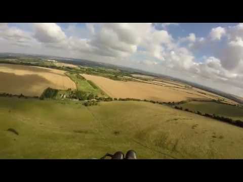
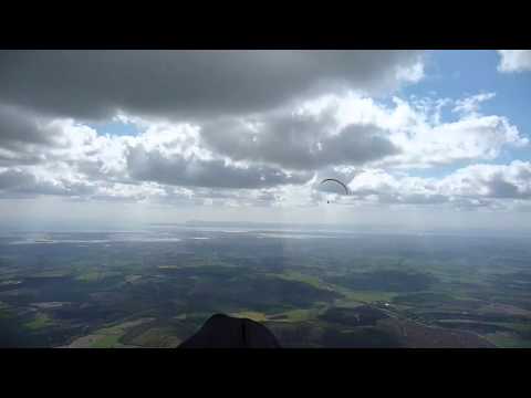
For more visual information, you can check out these videos:
- [Video 1](
Click to watch video
)
- [Video 2](
Click to watch video
)
The local club managing this site is the Thames Valley Hang Gliding Club (TVHGC). More details can be found on their [website](http://www.tvhgc.co.uk/).
**Wind Direction and Details:**
- Suitable for NW and SW winds.
- The ridge is approximately 0.75 km long and 75 m high.
**Restrictions:**
- Suitable for all levels of pilots.
**Sensitivity:**
- Erosion of the hill fort by cattle has led to the installation of a fence by English Heritage. If sheep are in the enclosure and the rear gate is closed, flying is not permitted. Notices may be posted at the bottom, but checking in person is recommended. Closures are usually brief.
**Location:**
- OS Grid Ref: SU 208 798
- From M4 Junction 15, take the A346 south towards Marlborough. Turn left past a garage sign-posted Hinton Parva and follow the road for approximately 1/2 mile. Liddington Hill will be on your right.
**Parking:**
- Park on the road near the steel gate, ensuring the gate remains clear for farm vehicle access.
**Access:**
- Climb over the hinged end of the steel gate (not the wooden stile or fencing).
**Take Off:**
- Approximate elevation is 250m/820’ AMSL.
- Take off anywhere along the new fence around the hill fort.
**Landing:**
- Land before the road. Hang gliders should note the limited and sloping landing area at the bottom.
**Hazards:**
- Turbulence from the pit in the middle of the west end of the field.
- The bottom landing area slopes towards the road, with a risk of overshooting due to lift near the fence.
- Flying the SW slope is challenging due to its small area, requiring caution.
**XC:**
- The site is quite thermic, especially over the farm buildings to the east of the ridge. It is recommended as an alternative to Combe when the wind is at least 10 km/h. Generally, follow the M4 until J14 at Hungerford, then fly towards Combe Gibbet and follow the usual route to the coast.
For more information, visit the [local club's website](http://www.tvhgc.co.uk/index.php/tvhgcsites/liddington-castle).
Popularity: 57 Views
Next optimal sessions
(Calculated by the Spots Guru algorithm)
Tuesday 17 June
04:48
21:26
2 days of Forecast per week are reserved for members.