BEST PARAGLIDING SITES IN BULGARIA
There is 326 sites to discover in Bulgaria and 1 guides available
Available guides:
Sopot
| Probability of Paragliding in the next days |
| 3 days |
7 days |
16 days |
| 77% |
74% |
61% |
Why Go to Sopot, Bulgaria
Sopot, nestled at the foot of the Stara Planina mountain range, is not just a small town in Bulgaria; it's a paragliding haven that has been attracting hang glidin ...
View guide
The Top 20 Paragliding sites in Bulgaria:
Sopot Stara Planina Сопот
/24.7502195315199,42.6876446335118,13/600x300@2x?access_token=pk.eyJ1Ijoic2Vic3dhbiIsImEiOiJjbGZsZ3E1MWowMXRtM3JucGZsbmVsNWlxIn0.NRc39EhAm1tQjmYNgV4zaQ)
Sopot, Bulgaria, is the most popular paragliding site in the country. It offers excellent soaring, thermal flying, and cross-country (XC) opportunities. The infrastructure is well-developed, including a cable car that takes you close to the takeoff point, followed by a 5-minute steep walk. The takeoff area is a large grassy peak that can accommodate more than 70 gliders, with exposures to the East, South, and West. Throughout the day, you can expect varying wind directions: E-SE in the morning, S at noon, and S-SW in the afternoon. The area is surrounded by thermal triggers, and even if you miss the first thermals, there are several house thermals below. Observing the clouds and following the birds can help you find the best thermals. For more information, visit:
https://www.skynomad.com/sopotAccess to the site can be achieved by hiking, chairlift, or a 4x4 vehicle. Note that the chairlift requires a minimum number of pilots to operate. The main landing zone is located at the bottom of the chairlift, with a dedicated landing site. An alternative, larger landing site is situated west of the bottom station, oriented E/W. The main landing area can be turbulent with west winds, so it's advisable to use the alternative landing field in such conditions. Local pilots and organizations:
https://www.skynomad.comhttps://www.sky-camp.com/bgAccommodation options include free camping at the main landing spot (Manastirska Polyana) with available water, as well as hotels and guest houses in the town of Sopot (e.g., Detelina, Sky View).
Other tourism options in the area include downhill tracks, XC cycling, hiking, and cultural visits such as the Ivan Vazov museum.
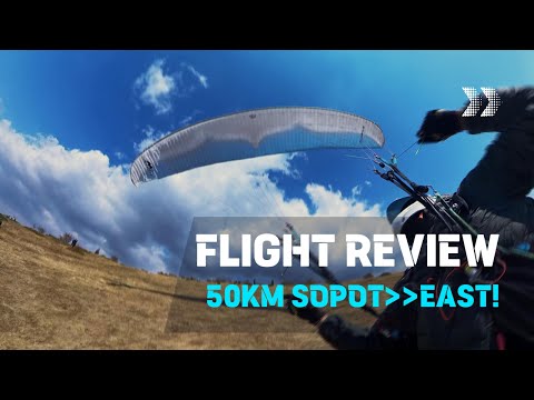
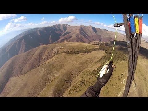
Click to watch video
Click to watch video
Click to watch video
Click to watch video
Click to watch video
Click to watch video
Click to watch video
Ravni vrah 3
H 1254 m is a lesser-known paragliding site in Bulgaria. It is not frequently used, but some cross-country (XC) flights are possible from this location. The site record for distance is 35.1 km.
View spot
Peak Botwv връх Ботев
Located at an elevation of 2310 meters, this paragliding site in Bulgaria offers a variety of takeoff options, making it a versatile choice for pilots. The site is regularly used and is known for its panoramic flights, providing stunning views of the surrounding landscape. Cross-country (XC) flights are also possible from this location, adding an element of adventure for more experienced pilots.
The site record for the longest flight is 43.6 km, showcasing its potential for extended flights. Although specific regional information is not provided, the site is popular enough to have a notable flight record.
For more details and to see flights near this point, you can visit the relevant paragliding information websites.
View spot
Bardoto Сопот/Бърдото: И-Ю-З
At an elevation of 1119 meters, this launch site is occasionally used and is more suitable for those who enjoy walk-and-fly experiences. Most flights typically start from the main launch in Sopot. This particular launch is ideal if you prefer hiking and solitude at the takeoff point.
Region: Sopot, Bulgaria
Site record: 47.0 km
To reach the launch site, start from the paved road near the rescue villa. At the highest point of this road, switch to the dirt path leading to Boykova Niva. From this path, another trail branches off towards the peaks of Malak and Golyam Kupen and the Dobril hut. It takes about an hour to reach the launch area, which is a large meadow with rosehip bushes and a shepherd's field above it, known as Bardoto.
For more information, you can explore flights near this point.
View spot
Ravnec Хижа Ражнец
The takeoff altitude ranges from 1270 to 1310 meters. This site is occasionally used and offers good potential for cross-country (XC) flights. There are various takeoff options available, making it a versatile spot for different wind conditions.
The site is located in Bulgaria, though the specific region is not mentioned. The site records for flights are 34.9 km and 32.5 km, indicating decent XC potential.
For more detailed information, you can visit ParaglidingEarth.
View spot
Voynagovo Tzarkvishte Войнягово/Църквище
/24.7164086539721,42.5796811227939,13/600x300@2x?access_token=pk.eyJ1Ijoic2Vic3dhbiIsImEiOiJjbGZsZ3E1MWowMXRtM3JucGZsbmVsNWlxIn0.NRc39EhAm1tQjmYNgV4zaQ)
The site is located on the northern ridge descending from Mount Karasivri in the Sredna Gora mountain range, Bulgaria.
Access to the takeoff is from the highest point on the road between the villages of Voynyagovo and Kliment. A dirt road branches off to the south and climbs the ridge to the takeoff point from the east. The upper half of this road is passable with a 4x4 vehicle but is quite overgrown on the sides. Upon reaching the ridge, a meandering and somewhat obscure trail leads north along the ridge.
Landing zones are the meadows below the takeoff area.
The site is best used in strong northwest (NW), north (N), and northeast (NE) winds. Interestingly, strong NE winds can break through at Beklemeto and reach the launch site as NW winds. The site works well around noon. In the afternoon, the NW wind usually strengthens, moving clouds and thermals south from the summit of Sredna Gora, leaving the northern slopes with broken and dispersed thermals.
To assess the wind conditions at the start, it is advisable to check the wind at the turnoff from the highest point of the asphalt road between Voynyagovo and Kliment. The strongest gusts there are usually similar to the lulls at the takeoff.
Flights have been made here in over 100 km/h NW winds at Botev, but the stratification of the atmosphere is also crucial.
For flying, combine soaring with thermals to climb to the peak of Mount Karasivri. When flying cross-country, follow the ridge of Sredna Gora. Further south, conditions generally stabilize. The most challenging area is around and after Pesnopoy/Banya before reaching Brezovo.
Be cautious with fire, as there has been an incident of forest fire in the past.
Local pilot contact: Nikolay Yotov +359899982575
More information: [Skynomad Forum Gallery](http://forum.skynomad.net/gallery/thumbnails.php?album=121)
View spot
Ravnec top
This paragliding site in Bulgaria, situated at an elevation of 1639 meters, is occasionally used and offers opportunities for hike and fly as well as cross-country (XC) flights. The site has a recorded flight distance of 34.9 km.
View spot
Bekleme NW Сиврия: СЗ
Altitude: 1579 meters
This site is rarely used and is primarily for walk & fly enthusiasts. The main flying direction is southbound for cross-country flights. There is also a nearby south takeoff option.
Region: Troyan-Karnare, Bulgaria. The site record is 26.9 km.
The takeoff is located on a ridge descending south from the main ridge. The initial launch is towards the northwest, heading towards the arch, and then immediately turning into the descending south wind. Landing zones are the fields around Karnare and Hristo Danovo.
This site is recommended for experienced pilots.
View spot
Dabene
Sopot, located in the Plovdiv region of Bulgaria, features a small hill with an elevation of 370 meters. This site is occasionally used and is ideal for training and practice flights. The site record stands at 15.1 km, making it a suitable spot for beginners looking to hone their skills.
View spot
връх Ботев alternative
H 2194 m is a lesser-known paragliding site in Bulgaria. It is situated at an elevation of 2194 meters. This site is infrequently used, but it does offer some potential for cross-country (XC) flights. The site record for the longest flight is 15.2 km.
For more information on paragliding in Bulgaria, you might want to check out local paragliding clubs or forums.
View spot
Beklemoto Christo Danowo Беклеме: И-Ю-З
/24.6126457906334,42.7418668666802,13/600x300@2x?access_token=pk.eyJ1Ijoic2Vic3dhbiIsImEiOiJjbGZsZ3E1MWowMXRtM3JucGZsbmVsNWlxIn0.NRc39EhAm1tQjmYNgV4zaQ)
Located in the region of Hristo Danovo, Karlovsko, Bulgaria, this paragliding site is frequently used and known for its good cross-country (XC) potential. It serves as a great alternative to Sopot and is accessible by road. The site allows for toplanding, making it convenient for pilots.
The take-off point is at an elevation of approximately 1340 meters above sea level, facing south, which is ideal for thermic conditions. The site record is an impressive 162.0 km, showcasing its potential for long-distance flights.
Landing areas are available in the valley, but be cautious as there is no official landing point. If thermals are not found, make sure to search for a landing spot in time. Note that landing near the villages of Hristo Danovo and Rozino may involve encounters with local groups who might ask for money or attempt to take your gear.
For more information on flying in Bulgaria, visit:
http://www.skynomad.com/Bulgaria_flying_sites.htm
Weather updates for Bulgaria can be found at:
http://www.skynomad.com/links_weather.htm
Additional details and flights near this location can be explored here:
http://www.paraglidebulgaria.com/en/beklemeto-south
View spot
Botwv 2
This paragliding site is situated at an elevation of 1970 meters and is considered difficult. It is rarely used, which might be due to its challenging conditions or less favorable flying opportunities. The site is located in Bulgaria, but specific regional details are not provided. The site record for distance flown here is 30.9 kilometers.
View spot
Sopot Govedarnata Сопот/Говедарната: ЮИ-Ю-З
Altitude: 1098 meters
This site is occasionally used for walk & fly activities and offers potential for cross-country (XC) flights.
Region: Sopot, Bulgaria
Site record: 47.0 km
Take off: Information not provided
For more details, you can explore flights near this location on relevant paragliding platforms.
View spot
Beklemeto Беклемето
Beklemeto, located in the Stara Planina region of Bulgaria, offers grassy slopes to the east of the arch monument on Beklemeto peak. This site is regularly used for soaring, and some cross-country (XC) flights are possible. Top landing is also feasible here.
The site record for Beklemeto is 19.4 km. Along the top of the ridge, which runs east-west, there are numerous spots suitable for takeoff. Historically, delta pilots used to take off west of the arch, but nowadays, most paragliding pilots prefer to take off from the east side.
For more details, you can visit [Paraglide Bulgaria - Beklemeto Arch](http://www.paraglidebulgaria.com/en/beklemeto-arch).
View spot
Равнец топ 1
This takeoff point is situated at an elevation of 1841 meters in Bulgaria. It is one of the less frequently used sites, offering a unique experience for those who prefer quieter locations. The site is suitable for hike-and-fly adventures and has potential for cross-country (XC) flights. The longest recorded flight from this location is 52.8 km.
For more information on flights near this point, you can visit [link to flights near this point].
View spot
Равнец топ 4
This paragliding site in Bulgaria, situated at an elevation of 1993 meters, is rarely used. It is particularly suitable for hike and fly enthusiasts. While it offers good potential for cross-country (XC) flights, it is not a popular choice among paragliders. The site record stands at 52.8 kilometers.
View spot
Ravnetz Hut
This paragliding site is situated at an elevation of 1288 meters in Bulgaria. It is occasionally used and is particularly suitable for hike & fly enthusiasts. The site offers good potential for cross-country (XC) flights, with the site record being 81.2 km.
For more information on paragliding in Bulgaria, you can visit [Paragliding Bulgaria](https://www.paragliding.bg/).
View spot
Равнец топ 3
This paragliding site is situated at an elevation of 1811 meters in Bulgaria. It is not frequently used, making it a quieter option for those looking to avoid crowded skies. The area offers numerous hike-and-fly opportunities, making it ideal for adventurers who enjoy combining hiking with paragliding. Cross-country flights are possible from this location, with the site record being 52.8 km.
For more information, you can explore flights near this point through local paragliding communities or forums.
View spot
Ravni vrah 2
This paragliding site in Bulgaria is situated at an elevation of 1959 meters. It is rarely used, primarily for soaring flights. The site record is 35.1 km.
View spot
Ravni vrah 1
This site, located at an elevation of 1917 meters in Bulgaria, offers a variety of paragliding experiences including toplanding, hike & fly, panoramic flights, and cross-country (XC) opportunities. The mountain provides multiple takeoff options, making it versatile for different flying conditions and preferences. The site record for distance is 35.1 km.
For more detailed information, you can visit ParaglidingEarth.
View spot
Other guides available in Bulgaria :