Trouves les meilleures sessions à proximité en 1 clic. simple, personnalisable et collaboratif
Parapente Truleigh Hill
Conditions Optimales
Optimal Wind Direction
Optimal Speed (mph)
Description
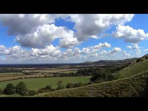
Truleigh Hill, located at the west end of the ridge from Devils Dyke in England, offers a unique paragliding experience. The site features a steep bowl with radio masts behind the ridge top. Historically, it was one of the first hills in the country where hang gliders were permitted to fly.
The site is rarely used but offers several takeoff options and the possibility for cross-country (XC) flights. Soaring is possible here, but it's essential to contact the local club before flying and follow the site rules. A briefing and day membership are necessary. You can find more details in the [SHGC Sites Guide](http://www.shgc.org.uk/files/siteguides/SHGC%20Sites%20Guide%202015e.pdf).
**Region:** England, UK
**Site Record:** 47.9 km
**Club:** [Southern Hang Gliding Club](http://www.shgc.org.uk)
**OS Grid Reference:** TQ 224110
**Coordinates:** 50° 53.1' N, 0° 15.6' W
**Wind Direction:** NNW – NNE
**Take-off Height:** 690 ft (210 meters) above mean sea level
**Height Top-to-Bottom:** 490 ft (150 meters)
**Site Pilot Rating:** CP+
**Airspace Restrictions:** 5500 ft
**Nearest Sat Nav Postcode:** BN5 9NL
**Description:**
Truleigh Hill is characterized by a steep bowl and is bordered by fence lines to the east and west of the radio mast, which mark the limits of the site. No launches should occur outside these boundaries. The site may be closed during the Lambing Season (March to May), so it's crucial to check with a club official if in doubt. To fly unsupervised, you must have top and slope landing tasks signed off.
**Landing:**
Top landings can be made anywhere within the site boundaries. Bottom landings are possible at the base of the slope or in the 'L' shaped field at the bottom. Landings can also be made within the training field to the right.
**Hazards:**
Be cautious of Shoreham ATZ to the south, directly downwind. There is a line of trees on the ridge top and radio masts behind it. The lower slopes above the training field are steep and hazardous for landing. Additionally, the site has numerous rabbit holes, particularly on the slopes.
**Rigging:**
Rigging should be done immediately behind the launch area, in front of the tree line.
**Directions:**
The site is on the northerly ridge to the west of Devil’s Dyke and can be accessed from the road running along the bottom of the ridge between Poynings and Tottington Manor. Access is via a track from the parking area, immediately to the west of the training field. Follow the track around the training field, cross a stile, and follow the path towards the take-off area. Avoid climbing over fences.
**Car Parking:**
Parking is available on the road (lay-by) at the bottom of the site. Ensure not to obstruct any gates leading into the field as they are in constant use.
For a visual overview, check out these videos:
- [Video 1](
Click to watch video
)
- [Video 2](
Click to watch video
)
- [Video 3](
Click to watch video
)
- [Video 4](
Click to watch video
)
Popularité: 58 Vues
Prochaines sessions optimales
(Calculé par l'algorithme de Spots Guru)
Dimanche 22 Juin
04:47
21:18
2 jours de Prévision par semaine sont réservée aux membres.