/-3.37556409483623,51.8561886032299,13/600x300@2x?access_token=pk.eyJ1Ijoic2Vic3dhbiIsImEiOiJjbGZsZ3E1MWowMXRtM3JucGZsbmVsNWlxIn0.NRc39EhAm1tQjmYNgV4zaQ)
Hike & Fly, occasionally used, soaring, XC possible on light wind days. This takeoff direction seems to be less used than the other ones.
Region: SE Wales - UK. Site record: 49.7 km. SW facing slope on spur immediately above waterfalls carpark at Talybont.
Good XC site on light wind days with mainly Southerly components. Might be rough in an Easterly. Suitable for all levels of pilots but lift can get strong at times.
Getting There:
Turn left from the A40 North from Crickhowell and Bwlch, on the way to Brecon. Drive to Talybont village. At the T junction, turn right past two pubs (The White Hart is better and has a bunkhouse, though some like the Star), and a small shop on the right (food available here). If it’s a good day, it’s a good idea to preplace a car here and share a lift to the top car park, as it’s often desperate to get back there after an XC. Turn left up and over the canal swing bridge and follow the road around for approximately 8 km past the reservoir (Tal y Bont) until the road turns left over a bridge and steepens dramatically. Follow it to the top, where there's a big car park on the right. Park here.
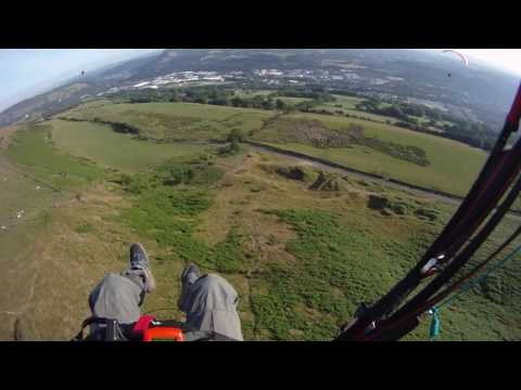
There should be little or no wind in the car park, or it will be blown out. The SW ridge above the car park (A) is OK at times and can also be used to hop across to B or, in a SE, soar with the option of flying round to C. To get there, go back out of the car park entrance and turn immediately right on a clear trail to the top of the hill. This walk-up shouldn't take much more than half an hour and can be done in less. There's a nice stream to stop and drink from two-thirds of the way up.
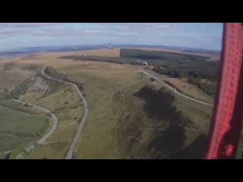
By far the best slope in a SW is the one at B but this is a much longer walk-up - approximately 1 hour. Go out of the back of the car park, up a driveable track and take a clear path off to the left, through to open country and a stile. Head along a track into the bowl, and drop down on a small track to the stream. Cross this and head steeply up to the top of the hill - a hard climb. As elsewhere, the top is clear and easily top-landable anywhere. In a SE wind, C provides a very obvious bowl, which flies well. There is also a smaller bowl to the E of B, which can be the only thing working when it's very, very light. C can be approached via A along a clear walkers path, which continues round to B. If you prefer your short, sharp shock at the beginning of the walk, this can actually be the quickest way to B, particularly if the large combe is very wet (I've had to wade the river a couple of times and the surrounding ground can be very marshy in Winter and Spring).
There's even a very nice NW face and N bowl over the back of C, which we've flown a few times on light and variable days. It's possible (but not by any means guaranteed) to fly all the way back to Talybont village from either this ridge or by hopping over the back of the tight bowl behind B (easier). You can land in the football field by the canal.
Steep Faces Cause Rotor:
Practically all of the faces at Talybont are very steep. This presents two problems: curl over on launch and rotor on landing - in both cases, you either need to be right on the front or 50+ yards back.
Specific Dangers:
In light wind conditions, it is possible to arrive at the long walk take off (B) to find a gentle breeze intermittently blowing up the slope. This can happen even in a South Easterly wind. The result of this can be very turbulent soaring conditions. In the bowl to the East of take off B, and in other bowls, it is possible to be 'flushed down' when the ambient wind regains supremacy. This has led to injuries with experienced pilots.
It is also possible for the wind to take on an unexpected direction change during flight. This is difficult to discern at height but can mean that a slope that once had a gentle breeze blowing up is now in the lee. It is strongly recommended that a GPS be used, so that ground speed can be monitored.
XC Potential:
In a SW wind you need to be aware that the Beacons drop off very sharply, so make sure you know where your second climb is or you'll end up in or around Brecon for 10 km. In SE or ESE winds, you can track over the highest point of the Beacons, Pen-Y-Fan (there's a couple of ridges running up to it that are easily soarable and a house thermal directly above the flat top), and on towards Heol Senni and Fan Gyhirych, from where you can cross to The Black Mountain. Several flights have also been made in the last couple of years, many by Avon pilots, back in the direction of Crickhowell and Abergavenny. If you're going this way, the conical hill on the E of the reservoir (Tor-Y-Foel) triggers nicely, particularly the top of the treeline above the reservoir.
Getting Back:
There's a bus from Brecon, even on Sundays in the Summer. A taxi from Brecon to the car park will cost you about 18 quid.
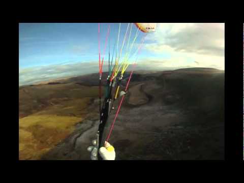
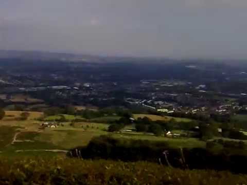
Wild scenery, the original WBPC site guide said 'take plenty of water: the closest thing to alpine flying in the UK'. It's a walk up, but boy is it worth it. A huge S-facing bowl that kicks off strong thermals in beautiful scenery. As epic as flying gets this side of Edinburgh.
Take off: Different take off depending on the wind direction (SW, E, S, SE & NW) and energy to walk up the hill. For more details please see the club webpage.
Landing: Please see the webpage for details. Be careful with top landings as the steep faces (apart from NW take-off) can create a rotor.
More information: [Avon Hangliding and Paragliding Club](http://www.avonhgpg.co.uk/sites/talybont.php)
[Fly South Wales](https://www.flysouthwales.co.uk/site-guides/talybont/)
Popularity: 44 Views