BEST PARAGLIDING SITES IN INDONESIA
There is 31 sites to discover in Indonesia and 1 guides available
Available guides:
Candi Dasa
| Probability of Paragliding in the next days |
| 3 days |
7 days |
16 days |
| 0% |
0% |
0% |
Exploring the Skies of Candi Dasa, Bali: A Paragliding Haven
Nestled on the tranquil northeast coast of Bali, approximately 1.5 hours away from the bustling streets of Kuta, lies the serene ...
View guide
The Top 20 Paragliding sites in Indonesia:
Candi Dasa Canddasa
/115.582613782053,-8.5148423805824,13/600x300@2x?access_token=pk.eyJ1Ijoic2Vic3dhbiIsImEiOiJjbGZsZ3E1MWowMXRtM3JucGZsbmVsNWlxIn0.NRc39EhAm1tQjmYNgV4zaQ)
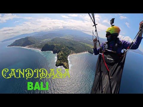
Candi Dasa in Bali, Indonesia offers a unique paragliding experience with an altitude difference of 225 meters and flight distances ranging from 1,000 to 4,700 meters. This site is known for its excellent coastal soaring conditions, although it sees relatively few logged flights. The views are spectacular, and on a lucky day, you might have the mountain all to yourself. The take-off point is located on a hilltop with black sand, which is about a 30-minute walk from the coast. The slope faces east, and the best flying season is from May to October. The landing zone is situated on the black sand beach. The wind and thermal conditions can be challenging, making this site suitable for pilots with some experience. The difficulty level is rated at 2, indicating that it is moderately challenging.
For more detailed information, you can contact Ketut, a local expert at Timbis who can provide additional insights and assistance. For further details, you can visit: - [Fly Bali](http://www.flybali.info/) - [Paralayang](http://www.paralayang.org/index.php?option=com_content&view=article&id=67%3Abali&catid=17%3Alokasi-terbang-di-indonesia&Itemid=96&lang=en) Additionally, you can watch videos of the site here:
Click to watch video
Click to watch video
For those who prefer a more relaxed flying experience over strenuous trekking, Timbis is a great alternative to Candi Dasa . there is a small hike roughly 10 mins up a steepish hill
Candi Dasa Canddasa lower launch
This paragliding site in Indonesia offers a height of 62 meters and a launch range between 1,000 to 4,700 meters. It is occasionally used and is known for good coastal soaring conditions. The site record is 3.7 kilometers.
View spot
Mount Batur
/115.379595937287,-8.23817632924196,13/600x300@2x?access_token=pk.eyJ1Ijoic2Vic3dhbiIsImEiOiJjbGZsZ3E1MWowMXRtM3JucGZsbmVsNWlxIn0.NRc39EhAm1tQjmYNgV4zaQ)
Mount Batur, standing at 1644 meters, is a popular spot for trekkers who enjoy camping and sunrise glides. You can hire guides for a more enjoyable experience. The site offers occasional thermal soaring opportunities.
For a visual experience, check out these videos:
[YouTube](http://www.youtube.com/watch?v=xa0tW8UvfwU)
[Vimeo](http://vimeo.com/8636313)
Located in Indonesia, the site record is 2.9 km. More details can be found [here](http://www.paralayang.org/index.php?option=com_content&view=article&id=67%3Abali&catid=17%3Alokasi-terbang-di-indonesia&Itemid=96&lang=en).
The journey to the top of Mount Batur takes around 2 to 3 hours. Wind and thermal conditions can be challenging during the day. The view of Lake Batur from above is unforgettable.
**Take-Off Location:** The summit of Mount Batur
**Landing Zone:** The village of Toya Bungkah
**Altitude Difference:** 750 meters
**Slope Direction:** South-East
**Flying Season:** All year round
**Difficulty Level:** Moderate
**Transportation to Take-Off:** On foot
For more information, visit [Paragliding365](http://www.paragliding365.com).
View spot
Timbis Bukit Nusa Dua
/115.192,-8.842,13/600x300@2x?access_token=pk.eyJ1Ijoic2Vic3dhbiIsImEiOiJjbGZsZ3E1MWowMXRtM3JucGZsbmVsNWlxIn0.NRc39EhAm1tQjmYNgV4zaQ)
Located in Bali, Indonesia, the coastal ridge soaring site on the southern tip of the Bukit Peninsula offers an exhilarating paragliding experience. The site is known for its frequently used launch points and good coastal soaring conditions, making it possible to achieve impressive distances.
The take-off area is situated at the top of a cliff with a sloped top area, providing a spacious and comfortable launch zone. The primary take-off location is Hill 100 Nusa Dua, while the designated landing zone is Timbis Beach. The flying season typically runs from May to October.
Wind conditions in this region are generally stable but can be strong. Thermals are rare, and the best wind direction is directly from the south, coming off the sea. The long beach cliffs are ideal for ridge soaring, allowing pilots to glide towards the west (Uluwatu) or east (Hotel Nikko).
For those interested in the site specifics, the coordinates are as follows:
- Road access: 8.8319 S, 115.19093 E
- Site location: 8.8420 S, 115.1918 E
The site features a 15 km long cliff, perfect for sea-side ridge soaring. Pilots can fly left towards the Niko Resort Hotel, where they can even soar above the hotel's pool, providing a thrilling spectacle for poolside guests. This site is also suitable for beginners and learners. A site fee of USD 20 is required, which is valid for 12 months.
When flying right from the launch, pilots can head towards the spectacular Ungala Cliffs. However, caution is advised when the wind is from the SSE to SE, as return flight penetration can be challenging, and there are limited landing opportunities below the cliffs. Additionally, rotor effects can occur at certain wind strengths, particularly at the Ungala end and about 50 meters back from the launch area ridge. In such conditions, it is safer to opt for a beach landing.
For more information, you can visit:
- [Fly Bali Info](http://www.flybali.info/co...)
- Contact Site Manager Ketut Manda at +62(0)8123 916918
- Ted Jenkins at enquiries@alpineparagliding.com
- [Alpine Paragliding](http://www.alpineparagliding.com)
For visual insights, check out these YouTube links:
- [Video 1](http://www.youtube.com/watch?v=nTSDo4yPnMI)
- [Video 2](http://www.youtube.com/watch?v=_2nbwwxyFgw)
- [Additional Video](http://www.youtube.com/watch?v=-T-pd9ZWhuA)
For more detailed information, including images and accommodations, visit:
- [Paralayang](http://www.paralayang.org/index.php?lang=en)
- [Paragliding365](http://www.paragliding365.com)
View spot
Gunung Payung Nusa Dua Timbis North
Gunung Payung, also known as the second launch site of Timbis, is located 3 km east of Timbis in Indonesia. This site is particularly useful when the wind direction is too easterly for Timbis. The launch and landing areas at Gunung Payung are more suitable for top landing compared to Timbis itself. Essentially, it is the same flying area as Nusa Dua. Note that some flying sites in Indonesia are listed multiple times on various websites.
For more information about this flying site, including detailed site information, images, and accommodation options, visit [Paragliding365](http://www.paragliding365.com).
For additional details, you can also check [MonkeyPara](http://www.monkeypara.com/areas/timbis).
View spot
Samosir Island Sihulakhosa Hill
/98.8487386514906,2.64005082492983,13/600x300@2x?access_token=pk.eyJ1Ijoic2Vic3dhbiIsImEiOiJjbGZsZ3E1MWowMXRtM3JucGZsbmVsNWlxIn0.NRc39EhAm1tQjmYNgV4zaQ)
Siulakhosa paragliding site on Samosir Island at Lake Toba offers an exhilarating experience. The launch altitude is 1470 meters with a height difference of 550 meters, making it suitable for easy thermal soaring. However, no flight logs are available for this site.
Getting to Siulakhosa can be challenging. It involves a two-hour motorbike ride from Tuk-Tuk, with about half of the journey on rocky roads through the forest. Despite the rough terrain, the effort is worthwhile. Hiring a local guide with a sturdy bike is recommended, costing around €15 or Rp. 18,000 per ride.
Without upwinds or thermals, the flight to the Bukkit Beta landing site, a hill near Tuk-Tuk with cell phone antennas, lasts about 7 minutes. Therefore, it's crucial to assess weather conditions thoroughly before heading to the launch site.
For more information, you can visit:
- [Paralayang.org](http://paralayang.org/index.php?option=com_content&view=article&id=97&Itemid=136&lang=in)
- [Paragliding in Samosir Island](http://tobaguide.com/places/paragliding-in-samosir-island)
- [YouTube Video](http://www.youtube.com/watch?v=90vQHrdirzA)
Samosir Island, located in the middle of Lake Toba, the world's largest crater lake, features a stunning paragliding site along a 300-meter high cliff. For more details, including images and accommodation options, visit [Paragliding365](http://www.paragliding365.com).
View spot
-HG Gunung Telomoyo
/110.398540877988,-7.36067670606315,13/600x300@2x?access_token=pk.eyJ1Ijoic2Vic3dhbiIsImEiOiJjbGZsZ3E1MWowMXRtM3JucGZsbmVsNWlxIn0.NRc39EhAm1tQjmYNgV4zaQ)
The take-off location is situated on Mount Telomoyo at an altitude of approximately 1800 meters above sea level. This site is primarily used for hang gliding, with a launch ramp specifically designed for hang gliders. It has hosted international hang gliding competitions such as the Telomoyo Cup.
The take-off area is owned by PT. Telkom telecommunications and is located near a transmitter. The scenery is stunning when the weather is clear, but the wind and thermals can be quite strong, making it a challenging site for pilots who enjoy mountain launches. The site is accessible by four-wheeled vehicles, making it relatively easy to reach.
The take-off direction is towards the North-West. The flying season is year-round, but the site is rated as moderately difficult, so it is recommended for experienced pilots.
For more information about the flying site, including images and accommodation options, you can visit [Paragliding365](http://www.paragliding365.com).
Please note that no flight logs have been found for paragliding at this location, and it appears to be quite tight for paragliders.
View spot
Gunung Banyak Batu/Malang
/112.496296183219,-7.85564220213751,13/600x300@2x?access_token=pk.eyJ1Ijoic2Vic3dhbiIsImEiOiJjbGZsZ3E1MWowMXRtM3JucGZsbmVsNWlxIn0.NRc39EhAm1tQjmYNgV4zaQ)
Located at an altitude of 1253 meters with a height difference of approximately 300 meters, this paragliding site in Java is renowned for its thermal soaring conditions. It hosted the Accuracy World Championship in 2010, highlighting its significance in the paragliding community.
**Take-Off Location:**
The take-off area is situated at the top of Mt. Banyak, 1300 meters above sea level. The slope direction is east, making it suitable for various wind conditions.
**Landing Zone:**
The landing zone is at SD Songgoriti, 1000 meters above sea level, with an altitude difference of 300 meters from the take-off point. The landing area is 950 meters in size, equivalent to a soccer field, and is located 1 km away from the take-off area. There is a guest house and a shelter available for pilots.
**Flying Season:**
This site is flyable year-round, although pilots should be cautious of wind and rainy weather during the northeast monsoon season (November-February).
**Difficulty Level:**
This site is rated as easy, making it accessible for pilots of all skill levels.
**Transportation:**
Access to the take-off area is typically by private vehicle. Batu is easily reachable by public transportation, being 100 km from Surabaya (approximately 2 hours by car) and 20 km from Malang (about half an hour by car).
**Coordinates:**
-7.855004, 112.496235
**Weather Information:**
For current weather conditions, you can check the Meteorology Malang Station [here](http://www.microsofttranslator.com/bv.aspx?from=&to=en&a=http%3A%2F%2Findonesian.wunderground.com%2Fglobal%2Fstations%2F96947.html).
**Flight Regulations:**
The site operates under FASI regulations, which is the Indonesia Air Sport Federation.
**Contact Information:**
For assistance, you can contact Yoshi Pasha at yoshi.pasha@gmail.com or visit Ayokitakemon! Outdoor activities at Jl. Arumdalu 20, Songgoriti, Batu 65312.
**Tourism:**
Batu is a well-known tourist city with numerous hotels ranging from bed and breakfasts to 5-star accommodations. Nearby attractions include apple plantations, orchid gardens, hot springs, amusement parks, swimming pools, and vibrant nightlife. The city is surrounded by mountains such as Mt. Bromo, Mt. Semeru, Mt. Arjuno, Mt. Welirang, and Mt. Panderman.
For more information, you can visit [Paralayang Batu](http://paralayangbatu.blogspot.com) and watch a video of the site [here](http://www.youtube.com/watch?v=fmNJyTepONo).
For additional details on the flying area, accommodations, and images, you can check [Paragliding365](http://www.paragliding365.com).
View spot
Singkarak
It seems there is limited information available for this paragliding site. No flight logs have been found, which might indicate that it is either a less frequented location or newly established.
The take-off point details are not provided. For more comprehensive information, you might want to visit specialized paragliding forums or websites dedicated to paragliding locations.
View spot
Mount Puncak
/106.984241839207,-6.70194444761501,13/600x300@2x?access_token=pk.eyJ1Ijoic2Vic3dhbiIsImEiOiJjbGZsZ3E1MWowMXRtM3JucGZsbmVsNWlxIn0.NRc39EhAm1tQjmYNgV4zaQ)
Located in Indonesia, this paragliding site offers stunning views and is particularly popular among hang gliding (HG) and paragliding (PG) pilots. The takeoff area, known as Bukit Gantole or Hang Gliding Hills, is situated above lush green tea plantations, providing a picturesque backdrop for your flights. The site is well-suited for tandem flights and paragliding schools due to its relatively gentle wind and thermal conditions, making it ideal for short flights and some thermal soaring.
The takeoff point is at an altitude of 1250 meters, with a landing zone located 250 meters below at 1000 meters. The slope direction is west, and the site can be flown year-round. The location is easily accessible, with public service vehicles available for transportation to the takeoff area.
Coordinates for the site are -6.702430, 106.985280. For weather updates, you can refer to the Citeko Meteorological Station.
The landing area is about 1 km from the takeoff point, still within the tea plantation. The Puncak Highlands, where this site is located, is just a 1-2 hour drive south of Jakarta, towards Bogor. Public transportation is also an option.
The area on the slopes of Gunung Mas is currently the most popular, offering breathtaking views of Java's rural countryside. However, be cautious of weather hazards, particularly wind and rainy conditions during the northeast monsoon (November-February). Wind speeds range from 8-25 km/hr, providing good lift. The best flight path is to the south, towards Mounts Pangrango and Salak, with Bogor City visible in the distance.
Flight regulations are governed by FASI, the Indonesia Air Sport Federation. For more information, you can contact Andhika Mountnear at info@mountnear.com or flymountnear@gmail.com. Local clubs and additional resources can be found at [Merapi Paragliding](http://www.merapiparagliding.com) and [Paralayang](http://www.paralayang.org/index.php?option=com_content&view=article&id=55%3Amerapi-paragliding-jakarta&catid=26%3Asekolah-dan-klub-paralayang&Itemid=106&lang=en).
Puncak Pass is a notable tourist destination in West Java, offering fresh mountain air and attractions such as the Bogor and Cibodas Botanical Gardens, the Gede Pangrango National Park, tea plantations, and the Safari Park. This site is one of the most frequented in Java, with shops and restaurants at the takeoff area, daily pilots, shuttle buses, and support staff to assist with your gear.
For more details, visit [Paralayang](http://www.paralayang.org/index.php?option=com_content&view=article&id=39%3Ajawa-barat&catid=17%3Alokasi-terbang-di-indonesia&Itemid=96&lang=en) and [Paragliding365](http://www.paragliding365.com).
View spot
Cemoro Lawang Lava View Lodge
Cemoro Lawang, Indonesia, offers a paragliding launch site situated at an elevation of 2220 meters. The exact coordinates are within 100 meters accuracy, but no flight logs are available for this location. The launch direction is unclear, although the direction towards the crater (southwest) appears to be sufficiently steep.
The launch site is located behind the Lava View Hotel. However, be aware that there are no good landing options in the vicinity.
For more detailed information about this paragliding site, including images and accommodation options, please visit [Paragliding365](http://www.paragliding365.com).
View spot
Matan Timali Pegunungan Gawalise Palu Sulawesi
/119.803676877546,-0.94955174251492,13/600x300@2x?access_token=pk.eyJ1Ijoic2Vic3dhbiIsImEiOiJjbGZsZ3E1MWowMXRtM3JucGZsbmVsNWlxIn0.NRc39EhAm1tQjmYNgV4zaQ)
Matantimali, Indonesia
Matantimali, located near the town of Palu on Indonesia's central Sulawesi Island, is a prime paragliding destination. The area is dominated by the majestic Gawalise Mountain, which rises to about 2600 meters above sea level, creating an ideal terrain for paragliding enthusiasts.
The take-off point in Matantimali is situated at approximately 1,100 meters above sea level. From here, you can enjoy breathtaking views of the sea as you glide down, soaring above a lush, forest-filled valley. The landing zone is located at GOR, which is at an altitude of 100 meters, giving you an altitude difference of about 1000 meters.
The slope direction for take-off is towards the southeast, and the site is accessible all year round. The location is moderately challenging, making it suitable for pilots with some experience. You can reach the take-off point either by public car or on foot.
For more information, you can visit the official website of the Indonesian Paragliding Open: [Indonesian Paragliding Open](http://www.indonesiaparaglidingopen.com/).
Additionally, you can watch a video of the launch of the 2011 Indonesian Open here: [Vimeo Video](http://vimeo.com/29646215#).
For further details about the flying site, including images and accommodation options, you can check out [Paralayang](http://www.paralayang.org/index.php?option=com_content&view=article&id=69%3Asulawesi-tengah&catid=17%3Alokasi-terbang-di-indonesia&Itemid=96&lang=en) and [Paragliding365](http://www.paragliding365.com).
Contact:
Arief Darmawan, Paragliding Club Young
Phone: 0451-424453, 0816240145
View spot
Bukit Jogo Wonogiri Gajah Mungkur
/110.896533755252,-7.84517113525272,13/600x300@2x?access_token=pk.eyJ1Ijoic2Vic3dhbiIsImEiOiJjbGZsZ3E1MWowMXRtM3JucGZsbmVsNWlxIn0.NRc39EhAm1tQjmYNgV4zaQ)
Wonogiri, located in Central Java, Indonesia, offers a unique paragliding experience. The launch site is situated at an elevation of 575 meters above sea level in the Stone Hills, which run from North-East to South-West. The takeoff point faces the Gajah Mungkur Basin, providing a scenic backdrop for your flight.
The cross-country route heads towards the North and North-East, flying over expansive flat rice paddies and small hills, which are ideal conditions for cross-country flying. Local pilots often frequent this site, although they do not always log their flights. Some enthusiasts consider it one of Indonesia's best spots for cross-country paragliding.
The region is known for its excellent thermals and significant cross-country potential. For instance, the distance to Solo City is approximately 40 km in a straight line, a route that local pilots regularly achieve. It is also possible to fly along a small mountain range towards the Northwest and return if the wind conditions are favorable. The best flying conditions are typically in the afternoon.
For more detailed information, including site records, images, and accommodation options, you can visit [Paragliding365](http://www.paragliding365.com).
Coordinates: S 7°50'43.1" E 110°53'47.3"
Region: Java, Indonesia
View spot
Ifar Gunung Danau Sentani
/140.535903039058,-2.55964332563251,13/600x300@2x?access_token=pk.eyJ1Ijoic2Vic3dhbiIsImEiOiJjbGZsZ3E1MWowMXRtM3JucGZsbmVsNWlxIn0.NRc39EhAm1tQjmYNgV4zaQ)
The paragliding site is located near Jayapura, Papua. The take-off point is on Irfar Mountain, with coordinates approximately at 02-33.36 'S 140-32.28' E. The landing zone is at the village football pitch in Pelloway. The altitude difference between the take-off and landing zones is 450 meters above sea level. The slope direction for take-off is south-facing, and the site benefits from a constant, strong breeze during the day, making it ideal for ridge soaring.
This site is operational throughout the year and is considered easy in terms of difficulty. Public transport is available to reach the take-off point. However, due to its proximity to Jayapura airport, it is crucial to check with locals about any restrictions or permissions required before flying.
For more information, you can contact Mujiono Eared Paragliding Papua at (0967) 593850 or fax (0967) 591434. You can also reach out via email at mujiono_sar@yahoo.com.
For additional details, images, and accommodation options, visit [Paralayang Papua](http://www.paralayang.org/index.php?option=com_content&view=article&id=68%3Apapua&catid=17%3Alokasi-terbang-di-indonesia&Itemid=96&lang=en) or [Paragliding365](http://www.paragliding365.com).
View spot
Lake Maninjau Danau Maninjau
/100.242506503138,-0.26348799628611,13/600x300@2x?access_token=pk.eyJ1Ijoic2Vic3dhbiIsImEiOiJjbGZsZ3E1MWowMXRtM3JucGZsbmVsNWlxIn0.NRc39EhAm1tQjmYNgV4zaQ)
Located in the Maninjau region of Indonesia, this paragliding site offers a breathtaking experience over Lake Maninjau. The lake, formed from rainwater accumulated over thousands of years, is surrounded by rugged slopes that provide a stunning backdrop for your flight. The area is known for its mild climate and high humidity, which can often result in mist at the takeoff point.
Takeoff is from an altitude of 1240 meters, providing a significant height difference of 761 meters to the landing zone. The takeoff site offers a perfect view over Lake Maninjau, making it one of the most beautiful flying sites in Indonesia. The slope direction is west, and the best flying season is from May to September. The site is frequently used by both locals and tourists, and cross-country flights are possible.
Landing is typically done in a former rice field close to the lake. Be cautious in the late afternoon as the wind from the lake can become quite strong, so avoid approaching too low.
The area is also a popular tourist destination, offering various tours with local operators. The region's natural beauty, combined with the excellent thermals, makes for an unforgettable paragliding experience. However, outside the dry season, weather conditions can be challenging with early cloud formation, often below the takeoff level.
For more detailed information, including images and accommodation options, visit [Paralayang](http://www.paralayang.org/index.php?option=com_content&view=article&id=33%3Asumatera-barat&catid=17%3Alokasi-terbang-di-indonesia&Itemid=96&lang=en) and [Paragliding365](http://www.paragliding365.com).
View spot
Gunung Merbabu
/110.43955164706,-7.45422812444601,13/600x300@2x?access_token=pk.eyJ1Ijoic2Vic3dhbiIsImEiOiJjbGZsZ3E1MWowMXRtM3JucGZsbmVsNWlxIn0.NRc39EhAm1tQjmYNgV4zaQ)
The paragliding site at Gunung Merbabu in Central Java offers a unique challenge for those who enjoy combining mountain climbing with paragliding. The take-off area is situated at an altitude of 2900 meters above sea level, and reaching it requires a hike of approximately 4-6 hours. The location provides various launch possibilities, primarily favoring westerly directions.
The best time to fly is in the morning before mist and high winds set in. The landing zone is located in the village of Tekelan, which is at 1750 meters above sea level, giving an altitude difference of 1250 meters between take-off and landing.
The site is accessible all year round and is rated at a moderate difficulty level. Transportation to the take-off point is by foot.
For more information, you can visit [Paralayang](http://www.paralayang.org/index.php?option=com_content&view=article&id=44%3Ajawa-tengah&catid=17%3Alokasi-terbang-di-indonesia&Itemid=96&lang=en) or [Paragliding365](http://www.paragliding365.com).
Contact:
- Sdr. Dragonflies, Merapi In Yogyakarta Club
- Phone: 0274-625772
Additional contacts:
- PLGI: Kav. PTB Blok D1/3 Duren Sawit Barat, Jakarta 13470, Phone/Fax: +62-21-8625533
- FASI: Bandara Halim Perdanakusuma, Lantai Dasar, Ruang No. 31-33, Jakarta 13610, Indonesia, Phone: +62-21-80899465
View spot
Pantai Air Manis Sweet Water Beach
The take-off location is situated at an altitude of 300 meters and is west-oriented. The area is surrounded by tall shrubs and trees, providing just enough space to set up a parachute. The landing zone is on Sweet Water Beach, which is at sea level (2 meters). Due to the palm trees, the landing area is not visible from the take-off point. The wind conditions are generally steady, influenced by the sea breeze.
The altitude difference between the take-off and landing zones is 300 meters. The flying season typically runs from May to September. The difficulty level of this site is moderate.
Access to the take-off point requires walking.
For more information, you can visit [Paralayang Sumatera Barat](http://www.paralayang.org/index.php?option=com_content&view=article&id=33%3Asumatera-barat&catid=17%3Alokasi-terbang-di-indonesia&Itemid=96&lang=en) or [Paragliding365](http://www.paragliding365.com).
View spot
Gedongsongo
Takeoff is at 1500 meters above sea level, accessible by a 20-minute walk from the parking area. You can also reach it by horse riding.
The landing zone is a very wide grass field with parking available for cars.
You can get there using a private passenger car.
Flight regulations are free for all pilots.
For more information, you can contact the G9 Paragliding Club.
Nearby tourism includes a Hindu Temple, surrounded by hotels and restaurants.
View spot
Princess Mountain Gunung Putri
Launch from the top of the Mountain Princess, located in West Java, Indonesia. The landing zone is at the Horticulture Field in Lembang. The slope direction is East-South-East, making it ideal for flights from May to September. This site is suitable for intermediate pilots. Access to the take-off point requires a 4x4 private vehicle.
For more details, including images and accommodation options, visit [Paragliding365](http://www.paragliding365.com).
View spot
Mount Haruman Gunung Haruman
/107.944593248114,-7.06911620479245,13/600x300@2x?access_token=pk.eyJ1Ijoic2Vic3dhbiIsImEiOiJjbGZsZ3E1MWowMXRtM3JucGZsbmVsNWlxIn0.NRc39EhAm1tQjmYNgV4zaQ)
Gunung Haruman, located in West Java, Indonesia, offers a unique paragliding experience. The take-off site is situated at an altitude of 981 meters with a height difference of 300 meters, making it suitable for small to medium flights. The journey to the take-off point is an adventure in itself, requiring a 4x4 vehicle due to the rugged, uphill terrain with sharp turns.
The take-off area is quite spacious, as is the landing zone. However, the wind and thermal conditions can be challenging, especially during peak sunlight hours. The best time to fly here is from May to September.
Take-Off Location:
- Eastern slopes at 950 meters
Landing Zone:
- Cibiuk at 450 meters
Altitude Difference:
- 500 meters
Slope Direction:
- Northeast
Difficulty Level:
- Medium
Transportation:
- Private 4x4 vehicles are required to reach the take-off site.
For more detailed information, you can visit [Paralayang](http://www.paralayang.org/index.php?option=com_content&view=article&id=39%3Ajawa-barat&catid=17%3Alokasi-terbang-di-indonesia&Itemid=96&lang=en) and [Paragliding365](http://www.paragliding365.com).
This site is occasionally used but offers a beautiful flying area with potential for cross-country flights. If you're in the region, don't miss the opportunity to fly here, as it may offer more potential than other well-known sites in Indonesia.
View spot
Other guides available in Indonesia :